STEP Matters 214
- Default
- Title
- Date
- Random
-
'What’s in a name?', asked Juliet of Romeo. 'That which we call a rose by any other name would smell…Read More
-
There have been several items of news that are making the Warragamba Dam project look increasingly less likely to proceed.…Read More
-
As one drives north along the M1 towards Gosford and cross the Hawkesbury River Bridge one has magnificent views of…Read More
-
The Wahroonga Estate was acquired by the Seventh-day Adventist Church in 1898 when the land was just an orchard. The…Read More
-
It is ten years since the Powerful Owl Project was initiated under the auspices of Birdlife Australia. This highly successful…Read More
-
We have a rival? Well actually no! The Southern Tablelands Ecosystems Park has very similar interests to ours. The Park…Read More
-
There are many books dedicated to nature and the environment, most of them good, some very good, but this one…Read More
-
I can't quote a price for this book because it was a gift or rather a swap. I met the…Read More
-
As one who enjoys long bushwalks and studying nature, having walked as a ‘swaggie’ from Yuleba to Surat along the…Read More
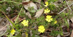
Hibbert’s flowers and Hitler’s beetle – what do we do when species are named after history’s monsters?
'What’s in a name?', asked Juliet of Romeo. 'That which we call a rose by any other name would smell as sweet.'
But, as with the Montagues and Capulets, names mean a lot, and can cause a great deal of heartache.
My colleagues and I are taxonomists, which means we name living things. While we’ve never named a rose, we do discover and name new Australian species of plants and animals – and there are a lot of them!
For each new species we discover, we create and publish a Latin scientific name, following a set of international rules and conventions. The name has two parts: the first part is the genus name (such as Eucalyptus), which describes the group of species to which the new species belongs, and the second part is a species name (such as globulus, thereby making the name Eucalyptus globulus) particular to the new species itself. New species are either added to an existing genus, or occasionally, if they’re sufficiently novel, are given their own new genus.
Some scientific names are widely known – arguably none more so than our own, Homo sapiens. And gardeners or nature enthusiasts will be familiar with genus names such as Acacia, Callistemon or Banksia.
This all sounds pretty uncontroversial. But as with Shakespeare’s star-crossed lovers, history and tradition sometimes present problems.
What’s in a name?
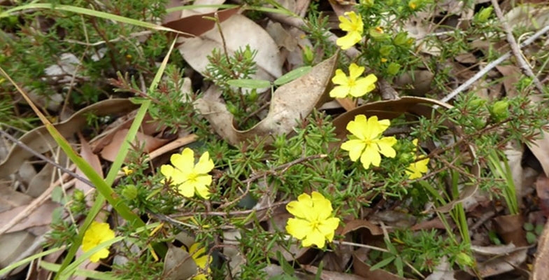
Take the genus Hibbertia, the Australian guineaflowers. This is one of the largest genera of plants in Australia, and the one we study.
There are many new and yet-unnamed species of Hibbertia, which means new species names are regularly added to this genus.
Many scientific names are derived from a feature of the species or genus being named, such as Eucalyptus, from the Greek for 'well-covered' (a reference to the operculum or bud-cap that covers unopened eucalypt flowers).
Others honour significant people, either living or dead. Hibbertia is named after a wealthy 19th-century English patron of botany, George Hibbert.

And here’s where things stop being straightforward, because Hibbert’s wealth came almost entirely from the transatlantic slave trade. He profited from taking slaves from Africa to the New World, selling some and using others on his family’s extensive plantations, then transporting slave-produced sugar and cotton back to England.
Hibbert was also a prominent member of the British parliament and a staunch opponent of abolition. He and his ilk argued that slavery was economically necessary for England, and even that slaves were better off on the plantations than in their homelands.
Even at the time, his views were considered abhorrent by many critics. But despite this, he was handsomely recompensed for his 'losses' when Britain finally abolished slavery in 1807.
So, should Hibbert be honoured with the name of a genus of plants, to which new species are still being added today – effectively meaning he is honoured afresh with each new publication?
We don’t believe so. Just like statues, buildings, and street or suburb names, we think a reckoning is due for scientific species names that honour people who held views or acted in ways that are deeply dishonourable, highly problematic or truly egregious by modern standards.
Just as Western Australia’s King Leopold Range was recently renamed to remove the link to the atrocious Leopold II of Belgium, we would like Hibbertia to bear a more appropriate and less troubling name.
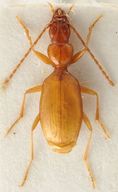
The same goes for the Great Barrier Reef coral Catalaphyllia jardinei, named after Frank Jardine, a brutal dispossessor of Aboriginal people in North Queensland. And, perhaps most astoundingly, the rare Slovenian cave beetle Anophthalmus hitleri, which was named in 1933 in honour of Adolf Hitler.
This name is unfortunate for several reasons: despite being a small, somewhat nondescript, blind beetle, in recent years it has been reportedly pushed to the brink of extinction by Nazi memorabilia enthusiasts. Specimens are even being stolen from museum collections for sale into this lucrative market.
Aye, there’s the rub
Unfortunately, the official rules don’t allow us to rename Hibbertia or any other species that has a troubling or inappropriate name.
To solve this, we propose a change to the international rules for naming species. Our proposal, if adopted, would establish an international expert committee to decide what do about scientific names that honour inappropriate people or are based on culturally offensive words.
An example of the latter is the many names of plants based on the Latin caffra, the origin of which is a word so offensive to Black Africans that its use is banned in South Africa.
Some may argue the scholarly naming of species should remain aloof from social change, and that Hibbert’s views on slavery are irrelevant to the classification of Australian flowers. We counter that, just like toppling statues in Bristol Harbour or removing Cecil Rhodes’ name from public buildings, renaming things is important and necessary if we are to right history’s wrongs.
We believe that science, including taxonomy, must be socially responsible and responsive. Science is embedded in culture rather than housed in ivory towers, and scientists should work for the common good rather than blindly follow tradition. Deeply problematic names pervade science just as they pervade our streets, cities and landscapes.
Hibbertia may be just a name, but we believe a different name for this lovely genus of Australian flowers would smell much sweeter.
This article was co-authored by Tim Hammer, a postdoctoral research fellow at the State Herbarium of South Australia.![]()
Kevin Thiele, Adjunct Assoc. Professor, The University of Western Australia
This article is republished from The Conversation under a Creative Commons license. Read the original article.
Nothing but bad news for Warragamba Dam’s wall raising project
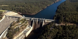
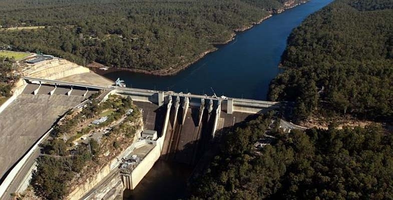
There have been several items of news that are making the Warragamba Dam project look increasingly less likely to proceed. Nevertheless, Stuart Ayres, the Minister for Western Sydney, is still determined to go ahead. He has dismissed the objections about the impacts on biodiversity and cultural heritage as unimportant. He argues that the flood mitigation that the wall raising is meant to achieve is vital.
The project is not the panacea that he promotes. The dam does not hold back flood waters from the several rivers below the dam that can flood the Hawkesbury Nepean Valley.
The insurance industry has suggested that houses on land that ‘should have never been developed’ below the 1 in 100 year flood level could be resumed. The cheaper mitigation option is to improve the roads and other infrastructure so it will be easier to escape a flood.
Several NSW government agencies have attacked the Environmental Impact Assessment (EIS) prepared by WaterNSW that was released in September, for example:
- the Environment, Energy and Science division of the Department of Planning noted that WaterNSW’s evaluation of the project’s impact on World Heritage values is based on ‘incorrect assumptions’
- the assessment of aquatic ecology had failed to identify that raising the dam wall would result in inundation of about 284 km of rivers and streams during floods
- the EIS' conclusion that the project would have minimal impact on threatened species was ‘not supported by the data or evidence’
- Heritage NSW's response to the EIS indicates that the assessment underestimated the area’s cultural significance, saying the impact to Aboriginal cultural heritage values would be ‘significant’
The International Union for the Conservation of Nature reported this month that the Greater Blue Mountains would be likely to lose their World Heritage status if it went ahead. They wrote to the federal government last month expressing their concerns about the EIS.
The assessment process is in the hands of the NSW government under the bilateral agreement with the Commonwealth, an arrangement that has been a cause for concern. Over 2000 submissions were received during the consultation period of which only 45 were in favour of the project.
Now the NSW government will have to do more work on the EIS, a process that will cost a lot more taxpayers’ money.
Peat Island development proposal at odds with Hawkesbury landscape
As one drives north along the M1 towards Gosford and cross the Hawkesbury River Bridge one has magnificent views of the river and the dense bushland on the surrounding hillsides.
Heading south there is a spectacular view of the sandstone cliffs created by the river and the cuttings that were made to build the freeway that now allows easy access from the Central Coast to the metropolis of Sydney.
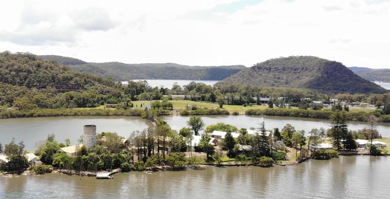
To the east there are two islands, Long and Spectacle. The natural values of the whole area are preserved as all these lands are national parks or nature reserves. The only development is low key with some houses clinging to the water’s edge or on available flat land such as in Brooklyn, Mooney Mooney and Dangar Island.
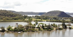
There is one area of development that has stood untouched for many years on Peat Island. This island originally housed a centre for treatment of alcoholics that was opened in 1910. It was later a general psychiatric hospital and a residential care centre for people with intellectual disabilities. It was closed in 2010 in line with the government policy to close down large institutional care centres. There are many historic buildings on Peat Island plus a chapel on the east side of the M1.
The nearby lands are the only flat areas available on the Lower Hawkesbury for community use. They provide access and views for the Lower Hawkesbury. In addition, the area contains many sites of cultural, heritage and spiritual significance to Indigenous and non-indigenous Australians.
The NSW government has been trying to sell off the land on Peat Island and on the narrow peninsula adjoining it near the M1 and Pacific Highway. In 2014 they proposed the development of 450 houses, mostly medium density building plus retail, tourism and community facilities. Fortunately it was knocked it back. It was totally inappropriate to have so much development in an area with no public transport or employment opportunities. The dwellings could end up being mostly holiday houses and make no contribution to housing needs.
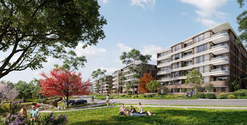
The Central Coast Council is currently considering a new concept plan proposal from the Department of Planning. This still has a significant amount of residential development on the land alongside the M1 with 105 houses and townhouses and medium density buildings with up to three stories with 162 apartments.
Peat Island would be transformed into a tourism and accommodation precinct, with supporting cafes, restaurants and the like to be accommodated in retained historic buildings and the addition of new buildings.
The chapel on the eastern side of the M1 has pedestrian access to Peat Island via an underpass. The precinct includes several historic cottages. The plan is to adaptively repurpose these buildings for community use plus the possibility of a community centre. However the whole area would be surrounded by some of the new housing.
There is also a possibility of a marina that Hornsby Council’s submission explains would cause several environmental issues such a damaging the estuarine mangrove environment and disturbing sediment contamination including asbestos.
These issues are apart from the fact that it would be totally out of keeping with the scenic landscape of the Lower Hawkesbury.
Hornsby Council’s submission also points out this level of development in an isolated area will exacerbate existing inadequate water and sewage management and parking facilities and cause traffic congestion.
The local groups opposing the plans are the Central Environment Network and Dyrarubbin Peat Island Association. Their view is that the concept plan lacks the vision and depth expected for an iconic site of regional, state and national significance. Dyarubbin is the First Nations Darug people’s name for the Hawkesbury River.
STEP believes the land should be developed for a world class park as the natural, cultural, heritage, aesthetic, social and recreational values of the site far outweigh the value as a residential area. This park should link the historic buildings and landscape of Peat Island to the broad sweeping landscape west of the M1 and to the intimate space of the chapel precinct. The historic buildings of Peat Island can be sensitively repurposed for cafes, cultural centres, museums, and a marine/ estuarine research centre. The proposed housing in the chapel precinct should be deleted as it severely impacts the curtilage of this building.
Submissions closed just prior to Christmas. We hope that common sense prevails. The NSW government has created some outstanding public parks such as Bicentennial Park at Homebush Bay. This Peat Island Park could be another example.
Final chapter of SAN development
The Wahroonga Estate was acquired by the Seventh-day Adventist Church in 1898 when the land was just an orchard. The land was then developed by the Seventh-day Adventist Church with the hospital, church and administration buildings.
A major redevelopment was planned in 2008. Plans have now been submitted to Ku-ring-gai Council for the final stage of this development on the San Hospital site. The concept plan for the developments was approved in 2010 by the Department of Planning under the controversial Part 3A process under the Environmental Planning and Assessment Act that took consultation out of the hands of councils and the community. Nevertheless, the plan ended up being significantly smaller than the original application submitted in early 2007.
STEP, the local community and local councils strongly opposed the plans. The department ruled that several reports submitted by the developer engaged by the SAN were inadequate.
The final stage covers the construction of four apartment buildings, one on Fox Valley Road and three behind the school with an access road from Fox Valley Road with traffic lights.
The design is for 178 apartments with 222 car parking spaces plus visitor parking. The approved plan was for 200 apartments in five buildings but, following Adventist school and local community consultation, more open space was allocated for use by the school.
A new set of traffic lights will be built near the entrance to the school and apartment complex. This is only a couple of hundred metres from the traffic lights at the entry to the hospital. Despite the claims that the new development will not worsen the current congestion this seems implausible.
Biodiversity management plan
During the prolonged approval process it was found that the ecological reports commissioned by the developer Johnston Property Group were seriously inadequate.
Ku-ring-gai Council vegetation mapping showed that proposed new housing on the eastern side of Fox Valley Road and creation of a new road would have destroyed one of the finest examples of vegetation transition from shale to sandstone soils. Also the vegetation mapping of the whole site confirmed that there were significant areas of critically endangered Sydney Turpentine Ironbark Forest and Blue Gum High Forest. The integrity of these areas would have been damaged by asset protection zone requirements.
When the mapping was corrected the areas of STIF and BGHF were sufficient to alert the federal Department of Environment (whatever it was called at the time – see note) of the potential damage to these critically endangered ecological communities under the Environment Protection and Biodiversity Conservation Act. The department ruled that the development was indeed a significant risk and made the development a ‘controlled action’. This means that the biodiversity management is subject to regular review and is detailed in a biodiversity management plan.
In the end the reduction in the residential development areas increased the bushland area from 18 ha to 34.1 ha, all zoned as E2, environmental conservation. The Adventist Church is responsible for implementation of the biodiversity management plan. A volunteer group called Wahroonga Waterways Landcare group managed by Adventist Aged Care also assists.
There is a huge amount of work to be done to restore the areas that were neglected for many years. However, the area along Coups Creek is magnificent bushland and is open to the public to enjoy. The area on the eastern side of Fox Valley Road is more problematic as a large part of it was reserved as a corridor for the freeway linking the F3 and M2 that was finally abandoned in 1995 (see Coalition Against the Lane Cove Valley Freeway 1988 to 1995: An Amazing Community Achievement. Some of this land is still owned by the NSW Department of Planning that doesn’t appear to be taking any action to control weeds like lantana and ochna.
Note on names of Australian government environment department
2010–16, Department of Environment, Water, Heritage and Arts
2016–20, Department of Environment and Energy
2020 to present, Department of Agriculture, Water and the Environment
Powerful Owl Project reaches a landmark
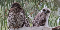
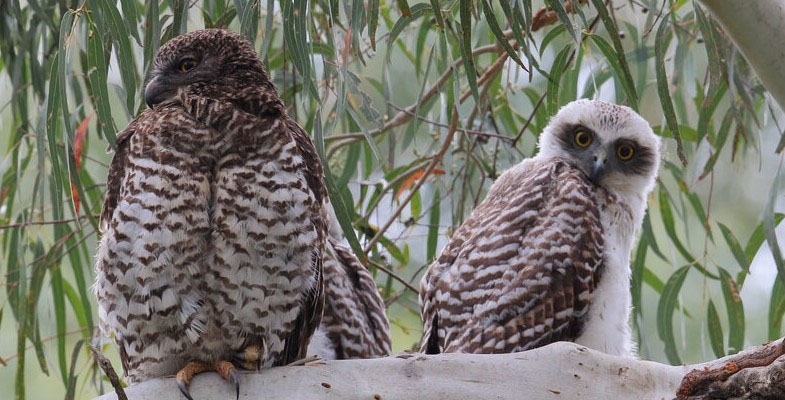
It is ten years since the Powerful Owl Project was initiated under the auspices of Birdlife Australia. This highly successful project aims to involve the general public in discovering information about the Powerful Owl population, their location and behaviour and carry out research into their health and habitat needs.
The intrepid citizen scientists have far exceeded the original expectation of finding 50 territories in Greater Sydney and surrounds; the total now is over 250. Their observations have contributed enormously to the understanding of the ecology of the Powerful Owl in the urban environment.
Here are some extracts from the newsletter that documents the experience of the last 10 years or so.
Breeding success
It’s been a good breeding season for our urban owls, with 95 successful breeding sites and 157 chicks fledged, up from 121 chicks fledged last year. It’s been a good year for double chick clutches, with 65.3% of clutches having two chicks, up from 39.5% last year. The table below gives an overview of the breeding season stats for the past few years.

Research into nesting hollows
We know Powerful Owls need large tree hollows to breed, but we don’t know much about the environmental conditions inside the hollows where successful breeding takes place.
In March 2021, data loggers were installed in 11 known Powerful Owl nesting hollows across the Sydney Basin, funded through Cumberland Bird Observers Club. The data loggers measured the temperature and humidity levels in the hollows during the breeding season and were retrieved again in November. A huge thank you to Kai Wild, arborist and environmental campaigner, who installed and retrieved the loggers.
Powerful Owls successfully use both dead trees and live trees for nesting. We had hoped to install the data loggers in a representative sample of each, but the dead trees proved too dangerous to climb.
We are rapidly losing our old, hollow-bearing trees through land clearing, bushfires, drought, safety concerns and natural attrition. A hollow suitable for a Powerful Owl to breed in takes 150 to 500 years to form. At current rates of loss, scientists have estimated that in 95 years there will be no suitable tree hollows left in the urban space that can accommodate the breeding of Powerful Owls.
The results of the analysis will be available in January 2022. They’ll help inform land management decisions around the retention of hollow bearing trees and help guide attempts to design artificial nesting structures for Powerful Owl. To date, all attempts have been met with owly disdain, other than on one occasion where the owls successfully fledged a chick from a nest box but have not returned to it in subsequent seasons.
Mortality
Sadly there were 82 death and injury events recorded in 2021. 85% of these birds were either killed outright or died in care due to their injuries. For all reports we received we collated all the information we could on where the bird was found, what the physical signs were and, where possible, bodies were collected and necropsied.
These numbers are, sadly, more than double that of 2020, largely due to a doubling in reported cases of motor vehicle accidents and an increase in death or injury from animal attack or from unknown cause. Of course, as people become aware of the ability to report incidents then of course reporting to us increases so it is difficult to determine just yet whether these events are increasing, or people are simply more aware of how to report them.
What we do know though is that motor vehicle accidents continue to be the largest single cause of death and injury in our urban owls with 39% of reported injuries/deaths in 2021 and 50.4% of injuries/deaths in our records since 2012.
What to do if you find an injured or dead owl
If you find an injured Powerful Owl do not attempt to rescue the owl yourself, for the safety of both yourself and the owl. The rescue of raptors requires specialist training and handling.
Assess the environment for any potential danger to yourself. Check if there are any immediate threats to the owl. Take note of your location (GPS coordinates or address). Then call a specialist wildlife rescue organisation and they will talk to you, assess the situation, and decide what action needs to be taken.
If you’re in the Sydney Metropolitan Area, please call either of the following (both available 24 h day, every day of the year):
- Sydney Wildlife Rescue on 9413 4300
- WIRES on 1300 094 737
If you find a dead Powerful Owl, please let someone know, as knowing how many Powerful Owls are dying, and where and why they are dying, is important for our understanding of how to support the survival of the species.
Rodenticides
The use of rodent poisons is a major concern for the survival of all raptor species. Of particular concern is what are called second-generation anticoagulant rodenticides (SGAR). These are rat poisons with the active constituents of brodifacoum. Studies of dead Powerful Owls has shown that we can add Powerful Owls to the more than 40 Australian animals and bird species that are poisoned by these products.
There is more work to come, but early results from our research are alarming and is why we will be pushing forward with this research and actively campaigning for the removal of these second-generation rat poisons from public sale. From our first batch of testing we have found:
- 37 of the 38 samples showed an anticoagulant rodenticide was present.
- The most common rodenticide present was brodifacoum. Brodifacoum is a SGAR, the most persistent anticoagulant rodenticide registered for use in Australia, and is the most common one used in rat poisons available on hardware and supermarket shelves.
- Nearly 60% of Powerful Owls tested had levels high enough to cause impairment. This likely puts these birds at greater risk of other threats such as being hit by vehicles – the leading cause of death we are seeing in these Sydney birds.
- An additional 10.5% had AR levels high enough to kill the bird outright.
How you can help
As the largest hardware retailer, Bunnings can be leaders in the market by removing a huge source of poison from their shelves and instead providing consumers with alternatives that are just as effective.
Sign our petition, but also use our Bunnings finder to (politely and respectfully) call your local Bunnings store and let them know you are concerned about this issue. We even have a script for you to use.
Powerful Owl Coalition
STEP is a member of the Powerful Owl Coalition, a group of northern Sydney environment groups that aims to promote improvement in habitat for Powerful Owls. We have been working with Dr Beth Mott the head of the project for the past five years. Sadly she has moved to another job. We greatly appreciated her extensive knowledge and assistance with our work.
News from another STEP
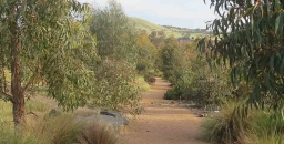
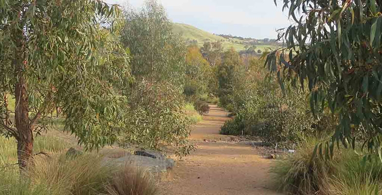
We have a rival? Well actually no! The Southern Tablelands Ecosystems Park has very similar interests to ours. The Park is a regional botanic garden, education and conservation centre demonstrating southern tablelands species within the National Arboretum Canberra (Forest 20).
The arboretum is a great scenic place to visit in Canberra. Its current layout was created after a radiata pine plantation was burnt out in the 2003 bushfires. There was already some forests on the site that had been established under Walter Burley Griffin’s plans for an arboretum. The plan is to create 100 forests and 100 gardens focussing on threatened, rare, and symbolic trees from around the world.
The site has been planted since 2005, and includes ceremonial trees planted by visiting heads of government and ambassadors.
Forest 20 differs from the other single species forests. STEP is growing 16 species of eucalypt trees, selected to represent the major vegetation types of the region; and it includes shrubs, herbs and grasses to demonstrate the understorey plants commonly found in the region’s forests and woodlands.
The STEP forest is an educational resource where visitors and school students can easily identify the trees and plants typical of the Southern Tablelands. Of particular significance are the trees and plants of the critically endangered Yellow Box/Red Gum Grassy Woodland ecosystem.
Forest 20 is managed by the STEP community group in partnership with the National Arboretum Canberra and welcomes individuals, community groups, schools and others to join this exciting project. STEP have regular working bees and other activities.
If you are ever in Canberra with some spare time, perhaps you should pay them a visit.
Book review: Tapestries of Life
There are many books dedicated to nature and the environment, most of them good, some very good, but this one is outstanding.
The author is a professor at the Norwegian University of Life Sciences and her previous book Extraordinary Insects made it to the Sunday Times best seller lists. Her special interests and research lie in forest ecology and in the role played by insects, fungi and other creatures in interacting with forest plants to create a natural living web. This is especially important in old growth forests whose biodiversity goes far beyond trees into the huge range of species that inhabit and live off not just the living trees but also dead, rotting wood or mouldy leaf litter. And here was a big surprise, her homeland of Norway, a timber producer, apparently has hardly any old growth forests left, most existing ones being sustained or created by managed regrowth and plantings. Lots of comments and thoughts to ponder in this topic on how we manage and respect our own old growth forests and natural world in general.
But this is far from the whole story in the book. It extends across an amazing array of animals and plants and their interactions, from Brazil nuts that require the unique orchid bee to pollinate, to fig wasps, to incredibly ‘intelligent’ slime moulds and to our own (probably extinct) gastric brooding frogs. And she goes quite a bit into the biopharmaceutical story too, from the blue blood of horseshoe crabs to a jellyfish called Turritopsis that can reverse its life cycle back to the polyp stage and can therefore technically live forever.
And a word about the style, which if it wasn't up to it could drag a book like this down into the dumps and make it heavy going however fascinating the content. Yes, she really does write well, and she acknowledges her English translator too who carries some share of the top marks for the final product.
Anne Sverdrup-Thygeson, Mudlark (Harper Collins), paperback 344 pp, $27.99
Reviewed by John Martyn
Book review: Mountains: Over Australia's Blue Horizon
I can't quote a price for this book because it was a gift or rather a swap. I met the author socially at a publishing friend's lunch – he received a copy of Rocks and Trees in return though I possibly got the better half of the deal!
The author Alasdair McGregor has multiple credits to his name, he is an architect, artist, writer, photographer, expeditioner and historian of Australian explorers and pioneers.
This book, Mountains, was created on request by the National Library following highly regarded previous works like Frank Hurley: A Photographer's Life and Mawson's Huts: An Antarctic Expedition Journal.
I warmed to this book because of a personal preference for ranges like the Snowies and Blue Mountains over ‘real mountains’ like the Swiss Alps. He quotes Sir Edmund Hillary's well known comment that Tasmania's Federation Peak is ‘Australia's only mountain.’ Jagged and formidable though it is only 1,224 m high, hardly on a world scale in elevation. But that isn't really the issue in our continent where ranges like the Blue Mountains and the high peaks of North Queensland were formidable barriers to early settlers and explorers whether in terms of terrain, vegetation or in getting on with the locals.
The style of description in the various chapters is broad and framed in a historical sense because to learn what it was like to traverse Australian mountain country in early settler days is a vivid introduction, and in the case of the Snowies, to follow through their history that included early cattle grazing, Von Mueller's botanical visits, gold mining, early skiing pioneers and the Snowy Mountains scheme paints a vivid picture. Though this is embellished with the sad accounts of threats to wildlife like the Bogong Moth and mountain pygmy possum, to wildfires and to the plague of wild horses. But the Snowies is a classic illustration that on our so-called flat continent we have alpine vegetation above the tree line in one corner and tropical rainforest in others. And our fractious summers bring both tropical mangos and cool climate cherries in abundance.
Some of Australia's mountain country he describes in the book I know well, like the Hamersley Ranges through years of geological fieldwork. But the chapter I probably enjoyed most was on country I don't know; the chapter on the high mountain peaks of far north-east Queensland where cloud forests with native rhododendrons are unique on our continent but threatened by climate change. And where it rains like you wouldn't believe. He also has vivid personal stories to tell from his experiences on Heard Island where he was in the first party to climb the awesome peak of Big Ben. He still regards that island as his most beautiful place.
Alasdair McGregor, NLA publishing (National Library of Australia); hardback, 268 pp
Reviewed by John Martyn
Book review: A Wide and Open Land: Walking the Last of Western Sydney’s Woodlands
As one who enjoys long bushwalks and studying nature, having walked as a ‘swaggie’ from Yuleba to Surat along the Cobb and Co coach route in 2018 and having walked 48 km in one exhausting day and night from a bogged vehicle in isolated Chesterton National Park, south west Queensland, I was very keen to grab hold of a copy of this recent book. Not only to read about Peter’s incredible walking journey but to learn about the natural history and cultural history of the huge Cumberland Plain which comprises much of western Sydney.
Living and working in Ku-ring-gai means I have become accustomed to the Hawkesbury Sandstone environs, but the fauna, flora and history of the Cumberland Plain still remains a mystery to me.
In the winter of 2019 ecologist Peter Ridgeway set out to walk 179 km across the Cumberland Plain, the region of rural land west of Sydney. Carrying his food and water and camping under the stars, he crossed one of the least-known landscapes in Australia, all within view of our largest city. I think he was as ‘game as Ned Kelly’ to undertake this venture in an area that is much under-loved for its amazing nature and today more valued as a dormitory for greater Sydney.
This well-illustrated book recounts a unique journey across a landscape few Australians will ever see. In this open country the familiar forests of Sydney’s sandstone are replaced by a fertile world of open woodlands, native grasslands and wetlands – known as the Cumberland Plain, home to some of the nation’s most unique and endangered wildlife. The Cumberland Plain is the traditional land of the Darug, Gundungurra and Dharawal peoples, and the birthplace of the first Australian colony and it is a landscape which also holds the key to our entwined and conflicted origins.
What was once a limitless tract of woodland is now being engulfed by the city to the east, in the largest construction project ever undertaken in the Southern Hemisphere – the near elimination of an ecosystem and a past community.
This book provides a detailed immersion into the history, wildlife, and culture of one of Australia’s most rapidly vanishing landscapes, and reveals how the destruction of ‘the west’ is erasing not only itself, but we are losing something central to the identity of all Australians.
Peter Ridgeway is a highly experienced biodiversity scientist and land manager for this remarkable area and his knowledge of the Cumberland Plain is fully reflected in his writings – almost a lament for the times when he grew up in the area when times were better – at least through his childhood eyes.
Peter’s book is literally a landscape memoir, nature guide and a detailed history narrative – all rolled into one amazing book. It has similarities to the late Eric Rolls history of the Pilliga A Million Wild Acres.
In addition to a very informative text, the detailed trip maps and lovely photographs add so much to the volume.
As stated by N Scott Momaday:
Once in his life a man ought to concentrate his mind upon the remembered earth, I believe. He ought to give himself up to a particular landscape in his experience, to look at it from as many angles as he can, to wonder upon it, to dwell upon it. He ought to imagine that he touches it with hands at every season and listen to the sounds that are made upon it. He ought to imagine the creatures there and all the faintest motions of the wind. He ought to recollect the glare of the moon and the colours of the dawn and dusk.
Peter Ridgeway has admirably achieved all of this in his wonderful landscape memoir. Please purchase a copy, you will not be disappointed!
Peter A. Ridgeway ($50) from the author (This email address is being protected from spambots. You need JavaScript enabled to view it.) or Nokomis (03 5774 7083 or This email address is being protected from spambots. You need JavaScript enabled to view it.)
Reviewed by Mark Schuster, Bushfire Technical Officer/Fire Ranger, Ku-ring-gai Council and NCC bushfire representative for Hunters Hill, Lane Cove, Parramatta and Ryde Bush Fire Management Committee

