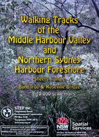
Walking Tracks of Middle Harbour (North)
The full-colour, double-sided map (revised and reprinted in 2023) is of the northern section of the Middle Harbour Valley, from Bungaroo to Roseville Bridge.
It shows bush tracks, cycleways and fire trails with connecting streets and access points. It is an excellent references and suitable for all users, from the occasional suburban stroller to the dedicated bushwalker. At a scale of 1 cm to 100 m (1:10 000) the level of detail is ideal for anyone wanting to explore the bush with beautiful colour photographs illustrating places of interest.
John Martyn was born in Cornwall and came to Australia in 1970 after mapping in the Rift Valley of Kenya for his PhD in geology. Although he has lived in Sydney since 1979, much of his fieldwork as a minerals exploration geologist over the last 30 years has been in Western Australia.
His first experience of spring in the West Australian goldfields left him stunned by the colour and variety of flowers in the bush. It was the beginning of a lifetime enthusiasm for Australia’s flora and fauna.
Moving to Sydney, John was amazed by the beauty and variety of landscape and habitats around the city’s suburbs. He has been exploring, mapping and photographing Sydney’s natural world ever since.
John joined the STEP committee in 1990 and has dedicated many hours to STEP’s campaigns and publications. John has assisted spreading STEP’s name and aims through the publication of the following books and maps of walking tracks:
- The Geology and Flora of the Sydney Basin: A Photographic Journey (2024)
- Rocks and Trees (2018)
- Understanding the Weather: A Guide for Outdoor Enthusiasts in South-eastern Australia (2013)
- Field Guide to the Bushland of the Lane Cove Valley (2010)
- Field Guide to the Bushland of the Upper Lane Cove Valley (1994, out of print)
- Sydney’s Natural World (2007, out of print)
- Map of Walking Tracks of Middle Harbour Valley and Northern Harbour Foreshore: Sheets 1 and 2 Bungaroo and Roseville Bridge (2004, 2009, 2023)
- Map of Walking Tracks of Middle Harbour Valley and Northern Harbour Foreshore: Sheets 3 and 4 Northbridge and North Harbour (2004, 2020)
- Map of Walking Tracks of the Lane Cove Valley (2000 and 2016)
John has also coordinated our walks and talks programs, with himself leading several very informative and eye-opening walks. In recent years, John has chosen wide-ranging landscapes such as Deep Creek at North Narrabeen, Kurnell and Botany Bay National Park, Dog Pound Creek and the Hornsby Diatreme, Ku-ring-gai Chase National Park at West Head, Cumberland State Forest and Bents Basin. The popularity of his walks for STEP has led John to host walks for Hornsby Shire Council.
It would not have been possible to produce this map without the help of of a team of dedicated volunteers who checked the details of the tracks and names of streets etc. Their work is much appreciated.
Volunteers included John Balint, Therese Carew, Bill Filson, Tim Gastineau-Hills, Gerald Holder, Simon and Joy Jackson, Bill Jones, Jan Kaufman, Kate Read, Jennifer Schwarz, Peter Tuft and Natalie Wood.
STEP was also supported by the late Bill Orme, Graham Spindler and Leigh Shearer-Heriot (North Sydney Volunteer Walkers Group), NPWS and the relevant councils.
Map cover pictures were watercolours by artist Janet Carter of East Roseville.


